Fishing Locations
Opening day for trout fishing in Rhode Island is usually mid-April. Licenses are required for anglers 15 years of age and older. Licenses many be purchased at Rhode Island’s city halls and town halls and many local bait and retail shops or online at the Licensing and Registration web page of the Rhode Island Department of Environmental Management.
Rhode Island residents are not required to have a license for saltwater fishing unless they wish to sell the catch. Out-of-state residents must have a license to shellfish in Rhode Island waters; also, they are forbidden to take lobster. For more information contact the Rhode Island Department of Environmental Management at 401-789-3094.
Click here to view Rhode Island Tide Charts
28 places to visit
Barrington, RI
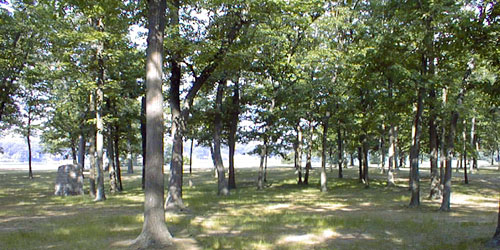
Haines Memorial State Park
Salt-water fishing in Narragansett Bay. Boat ramp is available.On Bullock's Cove, off Metropolitan Park Drive 401-253-7482Charlestown, RI
Quonochontaug Breachway to Quonochontaug Pond and Block Island Sound
The boat ramp at the inner end of the Quonochontaug Breachway provides access to Quonochontaug Pond and Block Island Sound. This boat launch is used by fishermen. The tide runs strongly through this breachway; take caution.
See full description of this location at our boat ramps page.End of West Beach Road, off Post Road / Route 1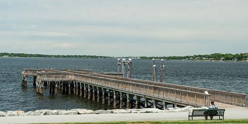
Bristol, RI
Colt State Park
There is lots of room for surf casting and shore fishing along the mostly rocky beaches of this large, open park on the eastern shore of Narragansett Bay. - Park Map (PDF)Route 114 at Asylum Road 401-253-7482New Shoreham (Block Island), RI
Ocean Avenue Bridge
Location: This bridge crosses over Trims Pond, a tidal pond that is connected to Great Salt Pond in New Harbor.Trims PondBlock Island, RI
Dunns Bridge
A popular fishing place is the bridge over the Harbor Pond Channel. This site has traditionally provided public access for fishing, scenic enjoyment, and shell fishing. No parking is available.Beach AvenueCharlestown, RI
Quonochontaug Breachway
Location: West Beach Road, off of Route 1. A popular fishing spot for striped bass, winter flounder, snapper, and Bluefish. Parking is available at the end of West Beach Road for cars and boat trailers. Toilets on-site.Charlestown, RI
Charlestown Breachway
The breachway has some of the best salt water fishing in South County and a panoramic view of Block Island Sound. there is a boat ramp of linked concrete slabs, a rock jetty, a wide sandy beach on the ocean, and an RV campground. There is parking and an entrance fee during season. No handicap access.West end of Charlestown Beach RoadNarragansett, RI
Black Point
Off Ocean Road, just north of Scarborough State Beach. A dirt path extends toward Narragansetts Bay from a parking lot just north of the old stone carriage house. On-site parking is available.Off Ocean AvenueNarragansett, RI
Middle Bridge Road access to Narrow River
The causeway and bridge crosed over the Narrow River. At the southwest end of the bridge there is a path to the Narrow River identified by a historic marker. There is restricted parking along Middlebridge Road. Trash receptacles are on-site.Middle Bridge RoadNarragansett, RI
Old Sprague Bridge Overlook
Location: East of Scenic Route 1A. The bridge abutments provide a view of the Pettaquamscutt Refuge and the Narrow River. There is parking available for cars on both sides of the river. Handicap access.Jamestown, RI
Taylor Point on Potter Cove
Potter Cove is a long sandy beach facing the East Passage of Narragansett Bay. The beach and Taylor Point are part of a town park where people like to fish, windsurf, paddle kayaks and have picnics. On the water here, prepare to handle large waves and heavy boat traffic. This is a site for launching hand-carried boats such as canoes or kayaks.at Freebody and Bayview drives- end of Barker Avenue
Bristol, RI
Mount Hope Fishing Access
A single-width concrete ramp that accommodates trailers leads into shallow water, protected by a breakwater on Mount Hope Bay. Nearby is a rocky beach and a marsh. Parking for 20 vehicles, or fewer with trailers. There's more parking along the entrance road.Off Annawamscutt DriveTiverton, RI
Seapowet Marsh and Point Fishing Area
Location: Off Seapowet Avenue, this refuge area includes a variety of coastal habitats. There is a parking area along a cobble beach north of the bridge over the Seapowet River and walking or driving access to Seapowet Point. There is a marsh on the point, popular for shellfishing. The beach is a good spot for walking, fishing, bird watching, or enjoying the view of the river.Off Seapowet AvenueLittle Compton, RI
Breakwater at entrance to Sakonnet Harbor
At the end of Bluffhead Road and at the mouth of the Sakonnet River a breakwater is at the opening of Sakonnet Harbor. The breakwater is good for walking and fishing. There is no public ramp. On-site parking is available.Bluffhead RoadNewport, RI
Van Zandt Fishing Pier
Just south of the Newport Bridge is a public pier at the crossing of Van Zandt Avenue and Washington Street to Narragansett Bay. There is no on-site parking.Van Zandt Avenue and Washington StreetNewport, RI
Goat Island Connector
This causeway links downtown Newport to Goat Island. It's a popular spot for fishing. A paved road and two concrete sidewalks extend from the circle in front of the hotel to the west side of the causeway and Newport Harbor. Curbside parking is available.Gladys Casrr Bolhouse RoadNewport, RI
Kings Beach Fishing Area
Kings Beach is a fishing access site at the east end of Brenton Point State Park. There is a gravel parking lot and a rocky beach for launching only hand-carried sea kayaks. Waves from the Atlantic are heavy, and only experienced sea kayakers should attempt this water.Off Ocean Avenue just west of Prices Neck RoadCoventry, RI
Carbuncle Pond
Carbuncle Pond is a pretty 39-acre pond in the Nicholas Farm Management Area. Two gravel parking lots lead to a handicapped-accessible fishing pier and to a concrete plank boat ramp. There are good places at both lots for launching hand-carried boats. Only electric trolling motors are allowed on the pond. The pond is stocked with trout several times a year.Off Plainfield Pike (Route 14)Lincoln, RI
Olney Pond In Lincoln Woods State Park
Trout fishing is done at this pond in a state park in northern Rhode Island. On the the east side of the park is a cement plank boat ramp suitable for launching trailered boats as well as hand-carried boats. Kayaks are available for rent here.Off Route 146South Kingstown, RI
Barber Pond
28 acres. Location: Route 102 to Route 2 South, about 7 miles on right. Parking: Yes.Barber's Pond Road, off Route 2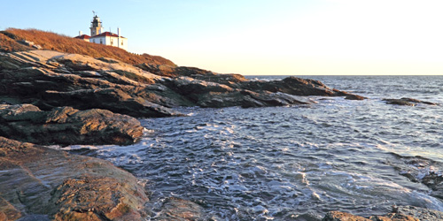
Jamestown, RI
Beavertail State Park
State park with glorious views at the end of Jamestown Island. Rocky shoreline is popular for surf casting.Beavertail Road 401-884-9834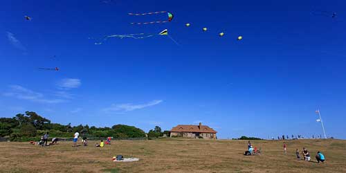
Newport, RI
Brenton Point State Park
Surf casting is popular from the rocky shoreline of this beautiful state park. Excellent views of Narragansett Bay, islands, a lighthouse, and sometimes surfers. See more info on our RI State & Local Parks page.Ocean Drive 401-847-2400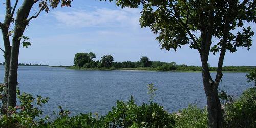
Charlestown, RI
Burlingame State Park
Fishing is done on Watchaug Pond at this popular state park. There is a boat ramp.1 Burlingame State Park Road 401-322-8910Charlestown, RI
Ninigret Park
Pond swimming, fishing; playground, fields, nature center, Frisbee golf
Fishing is done in a small pond in the park. Picnicking, a pavilion, and bathrooms are nearby.Route 1A just off Route 1 401-364-1222Tiverton, RI
Stafford Pond
476 acres. Route 24 East to Fish Road South, to Bulgarmarsh Road, take left on Route 81. Stafford Pond Road, access on left. Parking: Yes.off Old Stafford RoadRichmond, RI
Wyoming Pond (Wood River)
26 acres. Location: Route 95 to Route 138W, site just past intersection of Routes 3 and 138 and Bridge Street, on the right. Gravel ramp. Parking: YesBridge Street and Nooseneack Hill roadChepachet, RI
Pascoag Reservoir (Echo Lake)
352 acres. Location: Route 44 West to Jackson School House Road, North, site is ½ mile on the right. Parking: Yes.at Jackson Schoolhouse and Widow Smith roads