Walking and Hiking
Walking & Hiking - RI Statewide
Rhode Island's cities, seashore, woodlands, and parks all make wonderful places to walking and hiking when you’re looking for an enjoyable outdoor activity.
52 places to visit

Providence, RI
Go Providence
Walkable Providence means visitors can explore neighborhoods, encounter history
It’s easy to get out and about in Providence, RI, one of the country’s most walkable cities. Its vibrant neighborhoods invite strolling, with a happy variety of restaurants, shops and arts venues. Stop by the Providence Warwick Convention & Visitors Bureau’s Visitor Information Center to get a self-guided historic walking tour map to help explore the city by foot. At Waterplace Park, walk along the tidal basin; or take the kids on a scavenger hunt through Roger Williams Park. A walk along 1.2 miles of cobblestoned Benefit Street will reveal one of the country’s highest concentrations of Colonial buildings. For more info, visit GoProvidence.com1 Sabin Street 401-751-1177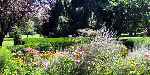
Westerly, RI
Wilcox Park
Lovely in-town Victorian Park; strolling; summer outdoor performances
Urban park of the Victorian period. Nice for walks, especially in flowering seasons. See more on our State & Local Parks page.71 High Street 401-596-2877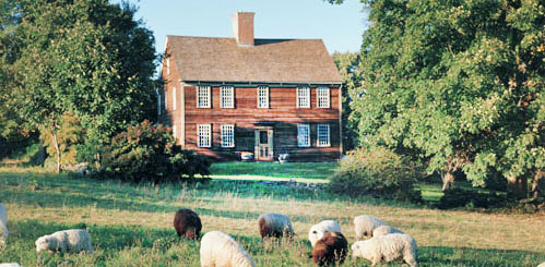
Jamestown, RI
Watson Farm
Started in 1796, this working farm is set on 265 acres and features cattle, sheep, horses, chickens and a garden. A two-mile walking trail and self-guided tours take visitors on a trip through the history and seasonal cycles of the farm. School programs and demonstrations are available.455 North Road 401-423-0005
Providence, RI
Benefit Street Walking Tours
Developed starting in the mid-1700s “for the benefit of all,” this Colonial neighborhood is lined with a gorgeous collection of 18th- and 19th-century wood-frame houses. It looks like a "museum mile," in all seasons, but it is actually a functioning neighborhood on the edge of the Brown University campus. Tours meet at the John Brown House, 52 Power Street.
Hours: Tours are offered June 15 to October 31; Monday, Tuesday, Thursday, Friday, and Saturday, 11-11:30 a.m.Benefit Street 401-273-7507
Block Island, RI
Lewis-Dickens Farm -- Audubon Society of Rhode Island
This 120-acre Dickens Farm Wildlife Refuge gives walkers panoramic views above the crashing waves of the Atlantic. Two easy-level trails traverse coastal meadows. Bird watchers often see raptors and fall migrants. This property also preserves a bit of Rhode Island's farming history. Birds sightings include barn owl, northern harrier, peregrine falcon, merlin, American kestrel, song sparrow, yellow-rumped warbler, and pheasant. No dogs allowed.Cooneymus Road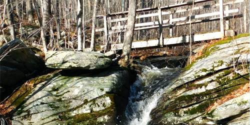
Coventry, RI
George B. Parker Woodland - Audubon Society of Rhode Island
An 860-acre property consisting of majestic old forest, brooks, fields, and mysterious rock cairns makes this a great destination for outdoor activities in Rhode Island such as walking or hiking. The caretaker's house was built in the 1700's. The barn has been converted into a nature center. From Providence take I-95 South to Rte. 102 North (Exit 5B). Take Rte. 102 North approximately ten miles. Turn right (east) onto Maple Valley Road (across Rte. 102, on the left is Waterman Hill Road). Turn into second driveway on the left for the trailhead or the first driveway for programs. Look for the Parker Woodland Wildlife Refuge sign.1670 Maple Valley Road 401-295-8283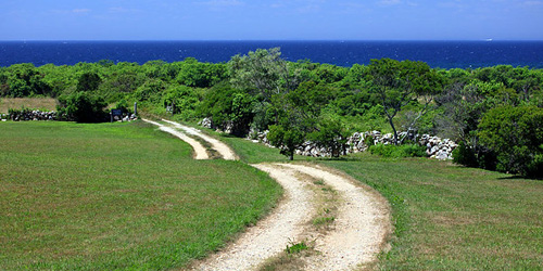
Block Island, RI
Greenway Trails of Block Island with the Block Island Nature Conservancy
Formed by glaciers nearly 10,000 years ago, Block Island features a diverse array of habitats. Birds stop here while migrating in the spring and fall along the Atlantic Flyway. About 25 miles of walking and hiking trails on Block Island are open to the public, free of charge. A full-color map showing all 25 miles of walking trails is available at the Nature conservancy office on High Street and at the Tourist Information Building in Old Harbor. Price $2
Please do not bike on the trails. The island’s many dirt roads offer excellent off-road biking opportunities. Lyme disease is common on Block Island. Take precautions to avoid deer ticks. Staying on marked trails will help you avoid ticks and poison ivy. Dogs are permitted, but please keep them leashed. Please remember that the dunes and bluffs are very fragile. Please stay clear of them for your safety.Office at 352 High Street 401-466-2129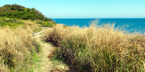
Block Island, RI
Clay Head Preserve
The Clay Head Preserve traverses beautiful scenery on Block Island, traversing bird-filled meadows, clay bluffs overlooking the ocean and a bunch of intertwining trails known as the Maze.
Directions: Look for a post marker on the right side of Corn Neck Road about two miles from town. Turn right down the dirt road and drive about one-third mile to a parking area and see the Clay Head sign.Corn Neck Road 401-446-2129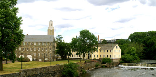
Pawtucket, RI
Pawtucket Downtown, Blackstone River, & Slater Mill
This walking route takes pedestrians along some of Pawtucket's most familiar buildings, landmarks, and waterfront of the historic Blackstone River Valley. Several walks are described at the website below, along Roosevelt and East avenues and near McCoy Stadium; there is no beginning or an end to these paths; they are all interconnected, and provide a great outdoor thing to do for families on vacation. Slater Mill is the site of the first textile mill in America, founded in 1793, using technology that Samuel Slater illegally smuggled out of England. It offers many public programs year-round and tells fascinating stories of America's industrial origins.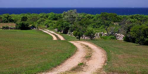
Block Island (New Shoreham), RI
Rodman's Hollow
This 230-acre glacial outwash basin is located in the southwest part of the island. Walk down Black Rock Road off of Cooneymus Road. About 0.25 miles down on your left, you will see a wooden gate and turnstile marking the trail entrance. Bear left, where the trail splits to traverse the bottom of the Hollow. Bear right to ascend a knoll with a wonderful panoramic vista. The trails intersect again to return to Black Rock Road. If you turn left and continue down the road, you can access the beach via a trail down the bluff.Black Rock Road 401-446-2129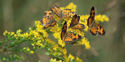
Charlestown, RI
Francis C. Carter Memorial Preserve
This large nature preserve is located partly on the rocky uplands of the Charlestown moraine and partly on the sandy floodplain of the Pawcatuck River. It supports a variety of plant and animal life, including pitch pine and scrub oak barrens, vernal pools, and grassland. There are many walking trails to explore Bow hunting for deer is permitted at the Preserve from September 15 to January 31. All visitors are required to wear a fluorescent orange hat or vest. Dogs are permitted but must be leashed at all times. Directions to the Preserve. Trail map (PDF)Old Mill Road 401-331-7110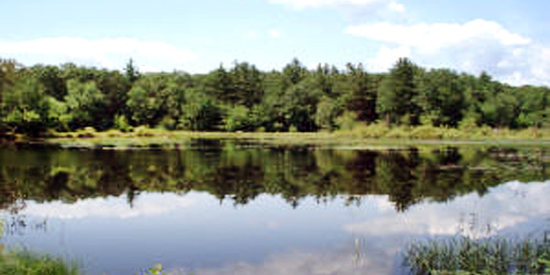
Richmond, Exeter, Hopkinton, and West Greenwich, RI
Arcadia Management Area
More than 14,000 acres of forest and managed wildlife property are crisscrossed by more than a dozen hiking trails. Many miles of gravel roads and well-maintained trails are used by hikers, mountain bikers and horseback riders. Uses include fishing, hunting, hiking, mountain biking, swimming, horseback riding and motorcycling. More on trails.260 Arcadia Road 401-222-6800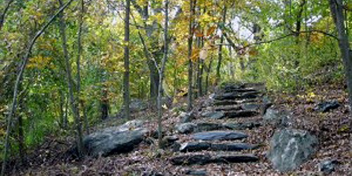
Providence, RI
Neutaconkanut Hill Conservancy
This 88 acres of green space and wilderness park is located, oddly, on the edge of the densely populated Silver Lake/Olneyville area of Providence, so it is easy to get to for residents and visitors to Providence. This wilderness park is 88 pristine acres of trees, fields, and wild flowers, interspersed with valleys, ravines, glacial boulders, stone walls, fresh water springs and brooks. The Hill is the natural habitat for a multitude of small woodland animals including deer, fox, and wild turkey. The Great Hill of Neutaconkanut was the northwest boundary in the land agreement between Roger Williams, founder of Rhode Island, and the Narragansett Sachems. Guided hikes are held the first Saturday of every month. Facebook .120 Killingly StreetNarragansett, RI
Canonchet Farm Trail
Canonchet Farm covers 175 acres of fresh-water and salt-water wetlands, forests, and ponds adjacent to Pettaquamscutt Cove on Narrow River. It is the home of a huge range of plants and animals. The old farm fields have grown into a forest of native plants and trees. The property has 1.5 miles of trails, maintained by the Friends of Canonchet Farm. The farm is right next to the South County Museum. The trails are open to the public for walking year-round, daily, during daylight hours. Also, guided walks and other presentations by natural history experts are open to the public. Trail map and brochure.
Hours: Year-round, daily, sunrise to sunset.Beach Street/ Route 1A to Anne Hoxie Trail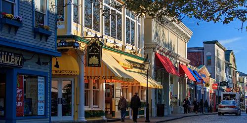
Newport, RI
Historic Downtown Newport
A stroll in the streets of downtown Newport, Rhode Island will take you along the water, past dozens of historic buildings, several museums and attractions, and through many outdoor malls and shopping centers. Wonderful in-town walking takes you deep into picturesque Colonial neighborhoods.Glocester, RI
Chepachet Village
This historic village is a fun, easy stroll through small-town America. Main street has funky antique shops, specialty stores, penny candy, Browns and Hopkins Store, Cyrus Cooke Tavern, old mills, and restaurants. The village is host of the annual Glocester Ancients and Horribles Parade on July 4. Go shopping, or just go walking and stroll around town and enjoy the scenery.
Information: www.glocesterri.org/tour.htmRoute 44 401-568-6206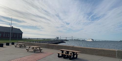
Newport, RI
Fort Adams State Park
Lots of nice walks on the huge park overlooking Newport Harbor, RI and the eastern flank of Narragansett Bay.80 Fort Adams Drive 401-847-2400Providence, RI
Brown University Walking Tours
The campus of one of America's oldest institutions of higher learning provides ample opportunity for both long and short walks.The neighborhood around Prospect Street 401-863-2378Middletown, RI
Norman Bird Sanctuary
This 450-acre refuge includes several wildlife habitats and seven miles of walking trails that are a great destination for a fun afternoon on your next Rhode Island family vacation. The site also houses an on-site museum, educational area, and small gift shop. Spring and fall bird walks are held there. In 2016, the Sanctuary finished a new, 1650-foot trail for people with disabilities. The universal trail winds through fields, wetlands and forest down to Red Maple Pond. It is accessible from the Welcome Center. - Trail Map (PDF)
Hours: Open Daily 9am - 5pm. Closed Thanksgiving & Christmas.583 Third Beach Road 401-846-2577Westerly, RI
Woody Hill Management Area
Gravel paths open only to foot and bicycle traffic are the main feature of this wildlife management area, set on 819 acres. Home to a variety of wildlife both on land and in the water.Woody Hill Road
Warwick, RI
Goddard Memorial State Park
There are lots and lots of walking trails through woods and across fields in this large park on Greenwich Bay. Trails used for horseback riding. No mountain bikes. - Park Map (PDF)1095 Ives Road 401-884-2010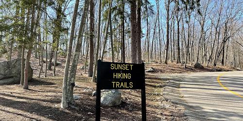
Lincoln, RI
Lincoln Woods State Park
Plenty of trails in the woods and around the lake at this forested state park an easy drive from Providence, RI. Trails are multi-use, welcoming walkers and hikers, mountain bikers and horseback riders. Designated horse trails are separate from multi-use trails.2 Manchester Print Works Road 401-723-7892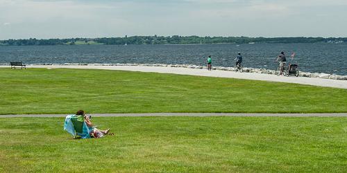
Bristol, RI
Colt State Park
This large, open park on the eastern shore of Narragansett Bay has many drives and trails for walking and biking. It is very close to the famous East Bay Bike Path. - Park Map (PDF)Route 114 at Asylum Road 401-253-7482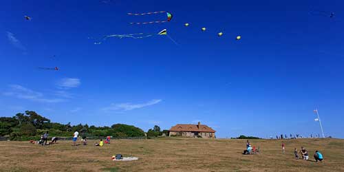
Newport, RI
Brenton Point State Park
Park rises above Ocean Drive and offers big, grassy slopes for walking and picnicking. Also, walks down to the rocky shoreline to explore the tide pools. See more info on our RI State & Local Parks page.Ocean Drive 401-847-2400Barrington, RI
Barrington Civic Center Historic District
The historic section of Barrington features the Barrington Town Hall, built in 1888, and the library. This unusual structure was built in a medieval style, with stone towers. The library is in a school from the early 20th century. Also on site, colonial cemetery and a pond.Providence, RI
Swan Point Cemetery
A historic cemetery with beautiful plantings and monuments. Walking and slow bicycloing allowed. Proper attire requested. Many noted Rhode Island politicians are buried here.585 Blackstone Boulevard 401-272-1314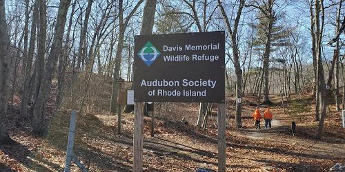
North Kingstown, RI
Davis Memorial Wildlife Refuge - Audubon Society of Rhode Island
A 90-acre property of woods and wetlands located on the Hunt River with access for canoeing and other outdoor activities such as walking and hiking. Take Exit 7 (Frenchtown Road/Davisville) off Rte. 4 South. Davisville Road (Rte. 403) is the left fork (follow signs toward Quonset Point/Davisville). Parking is on the right within 1/2 mile of the exit, immediately after the guardrail marking the Hunt River.Davisville Road 401-949-5454North Smithfield, RI
Fort Nature Refuge -- Audubon Society of Rhode Island
The headwaters of the Woonasquatucket River rise is on the 235-acre woodland. Three small ponds and a variety of deciduous and coniferous trees provide diverse habitats for wildlife in this area of Rhode Island that is perfect for walking when you’re looking for an outdoor activity. Take I-295 to Exit 8B (Route 7 North). Follow Route 7 North; bear right on Providence Pike. Go across at light at routes 5 and 104. Refuge is one-half mile on the left, the first left after the Primrose Fire Station. Information: www.asri.orgProvidence Pike 401-949-5454Rockville, RI
Long Pond Woods - Audubon Society of Rhode Island
A beautiful 218-acre parcel of stately hemlocks and rock outcrops bordering Long and Ells Pond. The Audubon Society of Rhode Island's land is a part of a large conservation area with trails connecting to Connecticut that are great for walking or hiking. Take Canonchet Road south from Rte. 138, then take the first right onto North Road.North Road 401-949-5454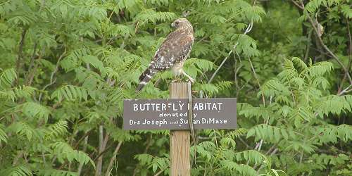
Greenville, RI
Powder Mill Ledges Wildlife Refuge -- Audubon Society of Rhode Island
This 120-acre refuge houses the Audubon Society of Rhode Island's headquarters. The refuge has fine stands of pines, a pond and a brook. The headquarters has a library, gift shop, and a bird-feeding station, making this a great destination for walking around and enjoying the outdoors when you’re looking for things to do in Rhode Island. From I-295 take Exit 7B onto Route 44 West. At fourth set of lights, turn left onto Route 5 (Sanderson Road). Turn left at second driveway into the parking lot.12 Sanderson Road 401-949-5454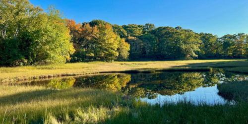
Tiverton, RI
Emilie Ruecker Wildlife Refuge - Audubon Society of Rhode Island
A 50-acre parcel of woods and salt marsh with a nature center and fine views of the Sakonnet River. The refuge has blinds for observing and photographing nature as well as plenty of land for walking and hiking while enjoying the outdoors. From Providence take I-195 East to Rte. 24 South (in Fall River, MA). Travel Rte. 24 South to the Rte. 77 South exit. Follow RTE.77 South to Seapowet Avenue. Turn right onto Seapowet Avenue and continue down the hill to the refuge parking lot on the right.Seapowet Avenue 401-949-5454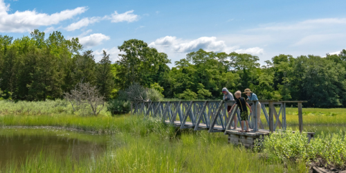
Warren, RI
Touisset Marsh Wildlife Refuge - Audubon Society of Rhode Island
These 66 acre are a fine example of salt marsh and bordering upland field and wooded habitat for visitors enjoy for walking and hiking in Rhode Island. A trail from the Touisset Fire Station on Touisset Road leads through fields to the Kickemuit River. Take I-195 East to Rte in North Swansea. Take Rte. 136 South to Rte. 103 (Child Street) in Warren. Go left (east) on Rte. 103 to Long Road. Go right onto Long Road and follow to end at Barton Avenue. Go left on Barton Avenue then t take first right onto Touisset Road. Follow it south to the next sharp left corner at fire station. Turn right into parking lot area and park at the westernmost edge of parking lot.Touisset Road 401-949-5454Westerly, RI
Lathrop Wildlife Refuge - Audubon Society of Rhode Island
This 86-acre property situated along the northern shore of Winnapaug Pond consists of coastal shrub land, freshwater wetlands, and salt marsh. A short walking trail leads from the parking lot down to the pond. From Rte. 1 South, take a left onto Rte. 1A (following signs to Misquamicut State Beach). Follow Rte. 1A approximately 3 miles. Look for the sign off left shoulder of the road.Shore Road 401-949-5454Exeter, RI
Fisherville Brook Wildlife Refuge - Audubon Society of Rhode Island
This 937-acre property contains fields, diverse forest habitats, pond, streams (including a waterfall) and a historic cemetery for people to explore while walking or hiking on their next vacation when they are looking for fun things to do outdoors. Take I-95 to Rte. 4 to Rte. 102 North. Turn right onto Widow Sweets Road (just after the Exeter Town Clerk's Office and across from Anderson's Quality Furniture Store). Take the second right onto Pardon Joslin Road (a dirt road). Travel approximately 1 mile. Parking lot is on the right side of the road by a large Fisherville Brook Wildlife Refuge sign.Pardon Joslin Road 401-295-8283West Greenwich, RI
Tillinghast Pond
Tillinghast Pond offers three looping hiking trails so you can walk as short or long as you wish. Bring your canoe or kayak and paddle on the pond and enjoy the solitude of these outdoors on your Rhode Island vacation.Narrow Lane or Plain Road 401-331-7110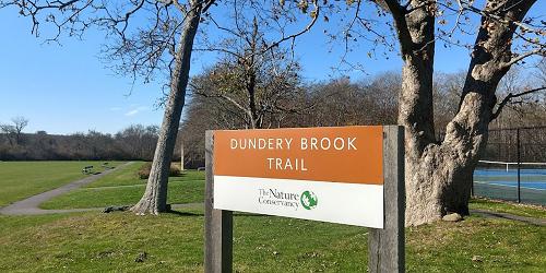
Little Compton, RI
Dundery Brook Trail
This 2.7-mile round trip stroll through a forested wetland includes a 3,100 foot long handicapped accessible boardwalk path connecting to a 4,100 foot long grass path around a pond on Bumble Bee Preserve. The path of the boardwalk zigzags across vernal pools, a sizable brook, two stone walls, and a treasure trove of biodiversity.Little Compton School, Meeting House Lane (park by the tennis courts) 401-331-7110Richmond, RI
Beaver River Preserve
Pleasant, babbling Beaver River flows through undisturbed acres that feature a small woodland pool, streams, and seeps, a bog pool and swamp, forested wetland and a mixed oak forest. There are two walking and hiking trails through the preserve. For your safety, please do not cross the timber bridge over the river. Information:Fox Ridge Drive 401-331-7110Lincoln, RI
Lime Rock Preserve
Only 10 minutes from downtown Providence, the preserve forms an oasis of tranquility and an important refuge for wildlife in an area that is heavily impacted by development. Ledges of dolomitic marble produce a special calcareous soil that nurtures 30 rare plant species. Beautiful ferns and wildflowers grow along ridges of recrystallized limestone.
Wilbur Road 401-331-7110Hopkinton, RI
Canonchet Brook Preserve
Canonchet is one of the largest natural areas in southeastern New England and is part of the Pawcatuck Borderlands site. Streams and wetlands are scattered through the forests. A trail starts at the parking area off North Road, heads down hill, crosses a small waterway, and passes some old building foundations. It then turns north and crosses Canonchet Brook. Follow the yellow trail blazes.
North Road 401-331-7110Charlestown, RI
Pasquiset Pond Preserve
Pasquiset Pond offers a diverse natural community. The wetlands support the rare ringed boghaunter dragonfly and an Atlantic white cedar swamp. A short loop walking trail leads through an impressive stand of mature white pines, while further south the Narragansett Trail runs through the property passing by numerous wetlands, mountain laurel, and a field.
Old Coach Road 401-331-7110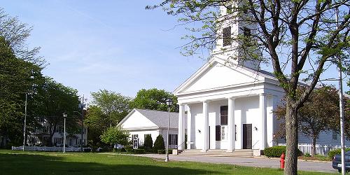
Slatersville, North Smithfield, RI
Slatersville Village Center, North Smithfield
The village of Slatersville, in the town of North Smithfield, is the pure image of a New England village: neat houses and white picket fences are arrayed along quiet streets, radiating from the town common and Congregational Church. Slatersville is recognized as America's first planned industrial village. The heart of the village is the large, stone Slater Mill. A walk here is delightfully picturesque and also a stroll through America's industrial history when you are looking for things to do one afternoon in Rhode Island.Coventry, RI
Maxwell Mays Wildlife Refuge - Audubon Society of Rhode Island
The Maxwell Mays Wildlife Refuge contains over 295 acres of diverse wildlife habitat consisting of upland forests, wetlands, streams, ponds and open meadow where people can visit and go walking or hiking during their next vacation or weekend getaway. The 11-acre Carr’s Pond, situated entirely within the bounds of the property, is the centerpiece of the preserve. It is home to river otters as well as many types of freshwater fish and aquatic invertebrates. The land is comprised of a relatively mature and undisturbed closed-canopy forest and forested wetlands as well as developed understory - creating ideal conditions for migratory and forest interior birds. A 10-acre field near the head of the trail also provides excellent meadow wildlife habitat.2082 Victory Highway (Route 102) 401-949-5454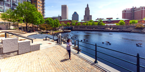
Providence, RI
WaterPlace Park and Riverwalk
Developed during a brilliant revival of downtown Providence starting in the 1990s, this park is largely a walkway along the 3 rivers that meet in the downtown, with delightfully fanciful footbridges that cross the river at intervals. At the end of the walk bracketed by Memorial Blvd., Francis Street, and Finance Way is a circular boat basin with amphitheater-type steps where outdoor performances take place in warm weather. The river is home to the famous WaterFire art installation of broadcast music combined with fires on the water that has charmed thousands of local people and visitors.Memorial Boulevard 401-785-9450Wickford in the Town of North Kingstown, RI
Wickford Village Walks
A walk around Wickford, a beautiful Rhode Island seacoast village on a cove off Narragansett Bay, makes a day of pleasures on a human scale. The village has been doing business since 1709, and it still bustles -- at a mellow pace. Great shops show cool jewelry, gifts, clothing, and more. Galleries are delightful, and there are plenty of places for a good meal. Walk past churches, colonial-period houses and gardens. Listen to the boats gently rattle their moorings from the decks of waterside restaurants.
Route 1A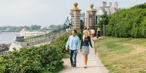
RI
Newport Cliff Walk
NOTE: Due to structural damage to a section of the Cliff Walk, detours are temporarily in place between Narragansett Avenue and Webster Street. The rest of the Cliff Walk is open as usual.
The Newport Cliff Walk is a 3.5-mile elevated, winding path along Newport’s shoreline with breathtaking views of Narragansett Bay and the rocky coves below. The walk runs from Bailey's Beach to First Beach, with public access points at Bellevue Avenue, Ledge Road, Marine Avenue, Ruggles Avenue, Sheppard Avenue, Webster Street, and Narragansett Avenue. The walk skirts the edges of some of the city’s mansions, including Beechwood, Rosecliff, Marble House, and The Breakers. The northern end of the walk, beginning at Memorial Blvd., is paved and easy; the southern end of the walk—less used by the public—has unpaved sections and rugged paths.
Jamestown, RI
Beavertail State Park
This beautiful park overlooking Narragansett Bay is surrounded by a rocky shoreline. Great fun to walk in the grassy highlands and especially on the rocks, exploring the life of tide pools are you go. Kids love it.Beavertail Road 401-884-9834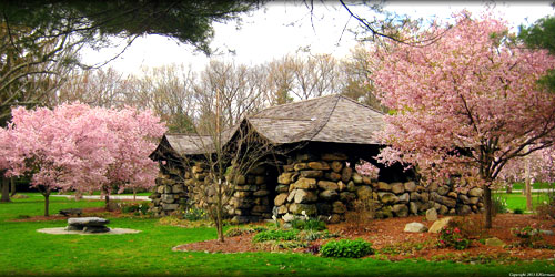
Providence, RI
Blackstone Park & Boulevard in Providence
Blackstone Boulevard is a 1.6-mile-long street in the upscale and beautiful East Side of Providence. It has a 100-foot wide median that is richly endowed with bushes and trees and a walking path. The street has bicycle lanes on each side of the median. The Boulevard is one of the landmarks of Providence and is listed on the National Register of Historic Places. This beautiful park attracts walkers and runners from all over the city. It is also very welcoming to bicyclists. Benches line the wide central path, and there is one substantial structure, a rustic stone shelter built over 100 years ago as a trolley stop. The park is cared for by volunteers and the Blackstone Parks Conservancy. - Park Map (PDF)Blackstone BoulevardSmithfield, RI
Mowry Conservation Area
This wooded area of 44 acres offer marked walking trails, places for picnics, and stocked trout stream, and stone wall left from an 18th-century forge. IN the warm seasons, water rushing through an old dam makes a nice little waterfall. An orange-blazed trail in the lower area, traveling through old hemlocks and pines, is the shorter loop. A yellow-blazed trail, accessible from the orange-marked trail, travels up a steep ridge and through hardwoods and mountain laurel. Together, the two trails equal about one mile.
Access: Look for the entrance sign and park along Old Forge Road between Farnum Pike (Route 104) and Log Road just north of Stump Pond.Old Forge Road between Farnum Pike (Route 104) and Log RoadSmithfield, RI
Ken Weber Conservation Area at Cascade Brook
Come to enjoy this land especially in spring and fall. A springtime brook and small waterfall, rock outcroppings, a walking trail, and a four-fireplace chimney remaining from another era. A one-mile blue blazed walking trail loops through the open, rocky forest, taking visitors to property’s high spots. The brook and small waterfall are the place’s best features, along with massive outcroppings and ledges, several stone walls and numerous stately trees.
Access: Enter off Putnam Pike (Route 44) at the sign for Village at Waterman Lake, at the western edge of Greenville, across from West Greenville Road. This entrance is Mapleville Road. Park at the end of the paved roadway (do not take the forks that go up to the left).Mapleville Road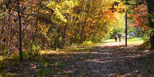
Smithfield, RI
Stillwater Scenic Trail
Once a railroad bed, the walkway now presents a place for easy strolls where walkers can enjoy scenes of the Woonasquatucket River as it flows into Stillwater Pond, as well as water birds, song birds, turtles, frogs and butterflies. About a half-mile from the start of the walk you reach Stillwater Pond and a dam. Beyond is a smaller pond and second dam, creating a nice waterfall, near Capron Road. There are many good places to cast a fishing line.
Access: Park in a gravel lot off Farnum Pike (Route 104) between Washington Highway (Route 116) and Stump Pond dam. The walkway runs under Washington Highway and along Stillwater Pond all the way to Capron Road.off Farnum PikeWesterly, RI
Napatree Point Conservation Area
This long, sandy spit separates Little Narragansett Bay from the Atlantic Ocean. Wonderful place for ocean views and bird watching. Sandy paths lead you to the remains of Mount Mansfield. There is a beautiful lagoon on the bay side. No water or services or any kind out on the point. Walking may be work for young children or people who are easily fatigued because you are walking in sand, not on pavement. Length is 2 to 3 miles.
Parking: Parking is behind a village shopping strip, in a paved lot off Bay Street near Fort Street. Best to visit in the off-season because parking at the small lot is very competitive in summer.
Season: Accessible all year; dogs prohibited May 2 through Labor Day from 8a.m. to 6 p.m.
Fees: Access is free.Bay Street to Fort Road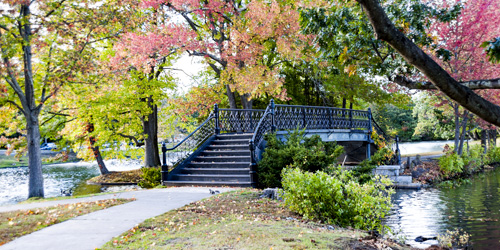
Providence, RI
Roger Williams Park
Roger Williams Park off Elmwood Avenue in Providence is a gorgeous Victorian-era park comprising 435 beautiful acres of drives that are great for walking or biking, lakes, a carousel, gracious buildings, a zoo and a museum and planetarium. The park offers lots of public events, and also some really helpful, downloadable maps that allow you to explore it on your own. Enjoy!
Map PDFs: Notable Buildings - Walking Trails - Notable Art - Notable Trees1000 Elmwood Avenue